Portfolio
UAS & Geospatial Work
This page collects work from both sides of what I do: UAS aerial imagery and GIS. The aerial section is still growing - I earned my Part 107 in 2026 and am actively adding to it as projects come in. The GIS section covers professional work from the City of Wenatchee and Franklin County, where most of my hands-on experience was built.
The two aren't unrelated. The longer-term goal is to bring them together - field data collection from the air, processed and fed into GIS workflows. Some of that integration is starting to show up in the aerial work below.
UAS & Aerial Work
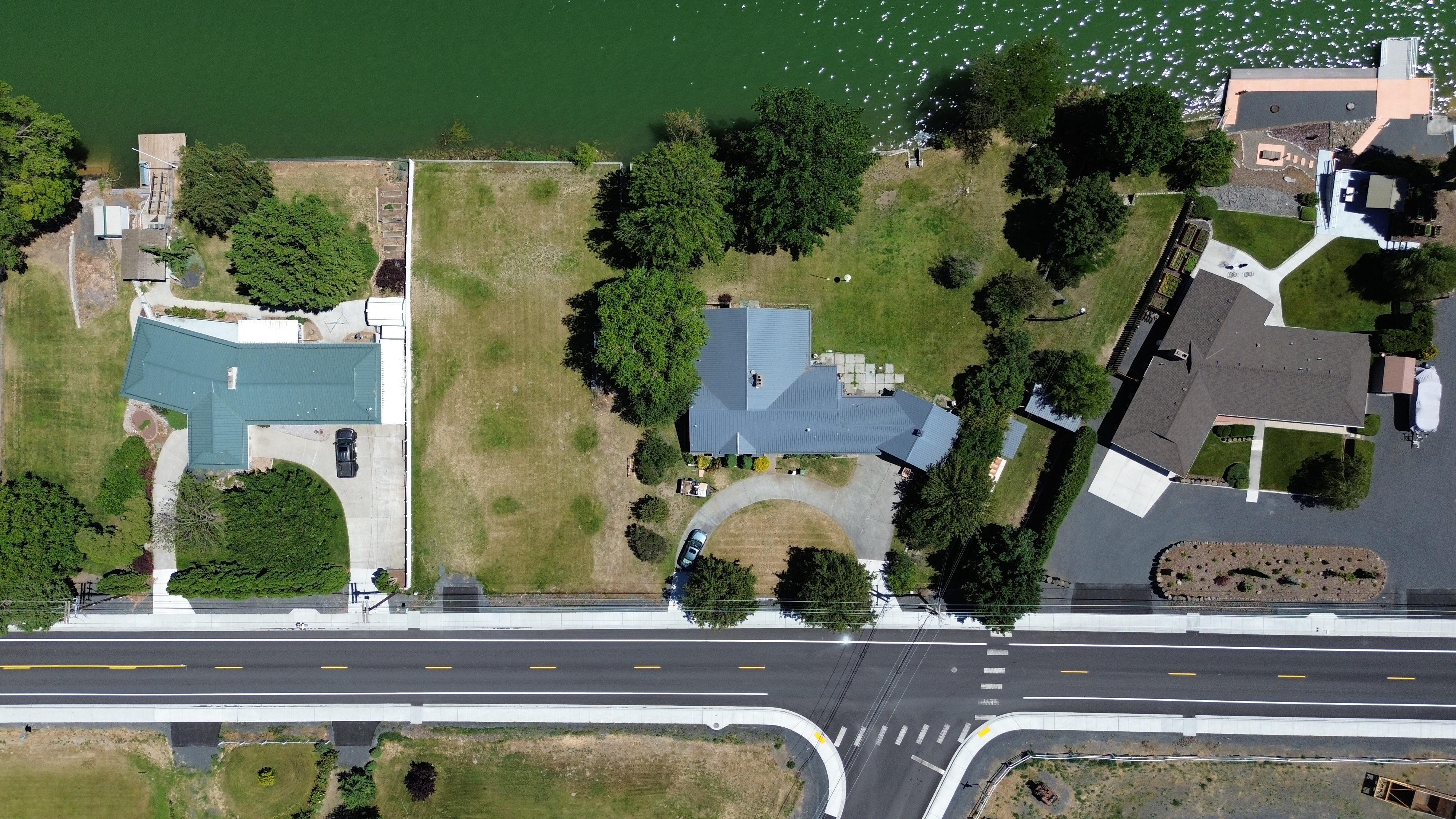
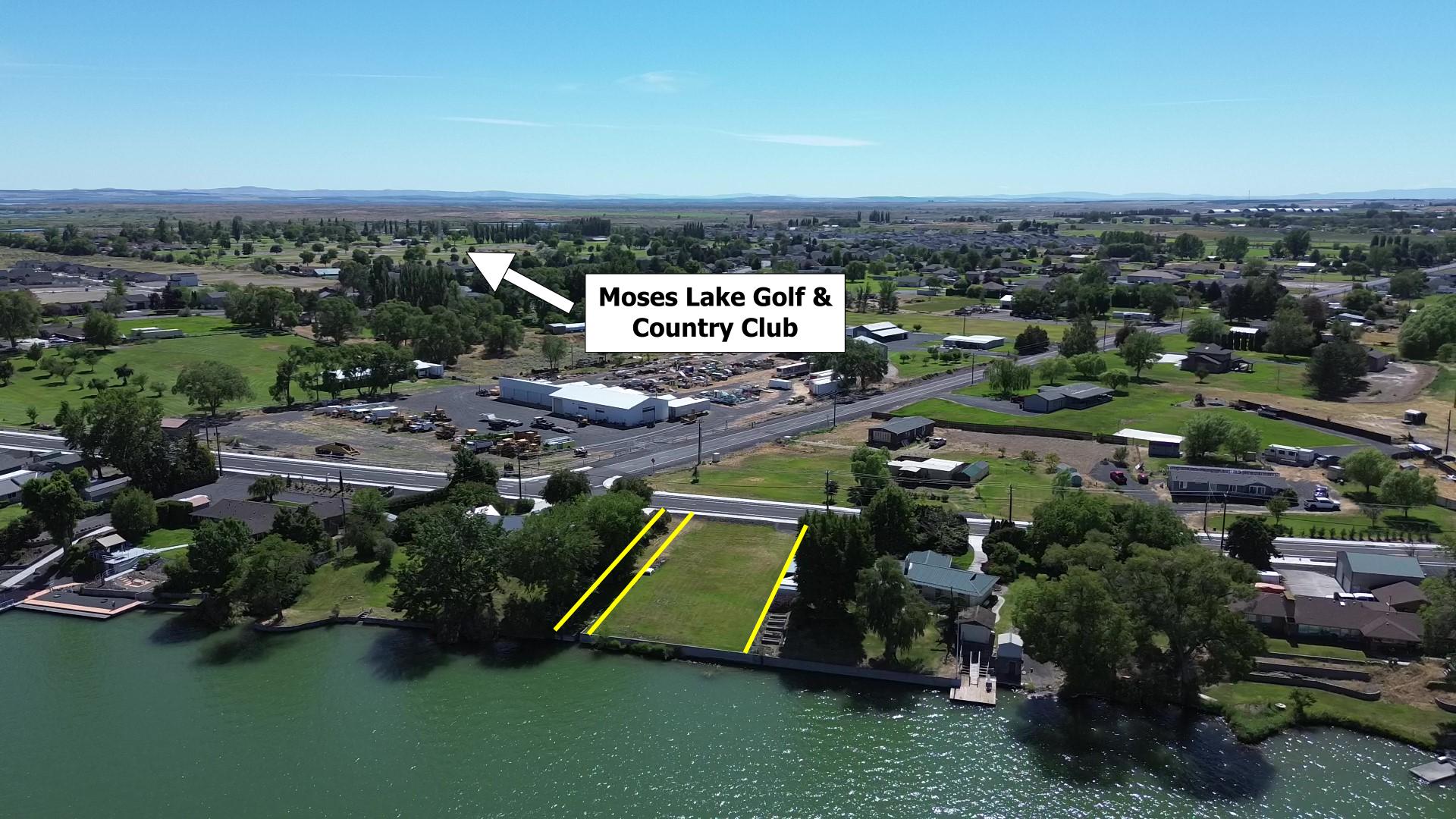
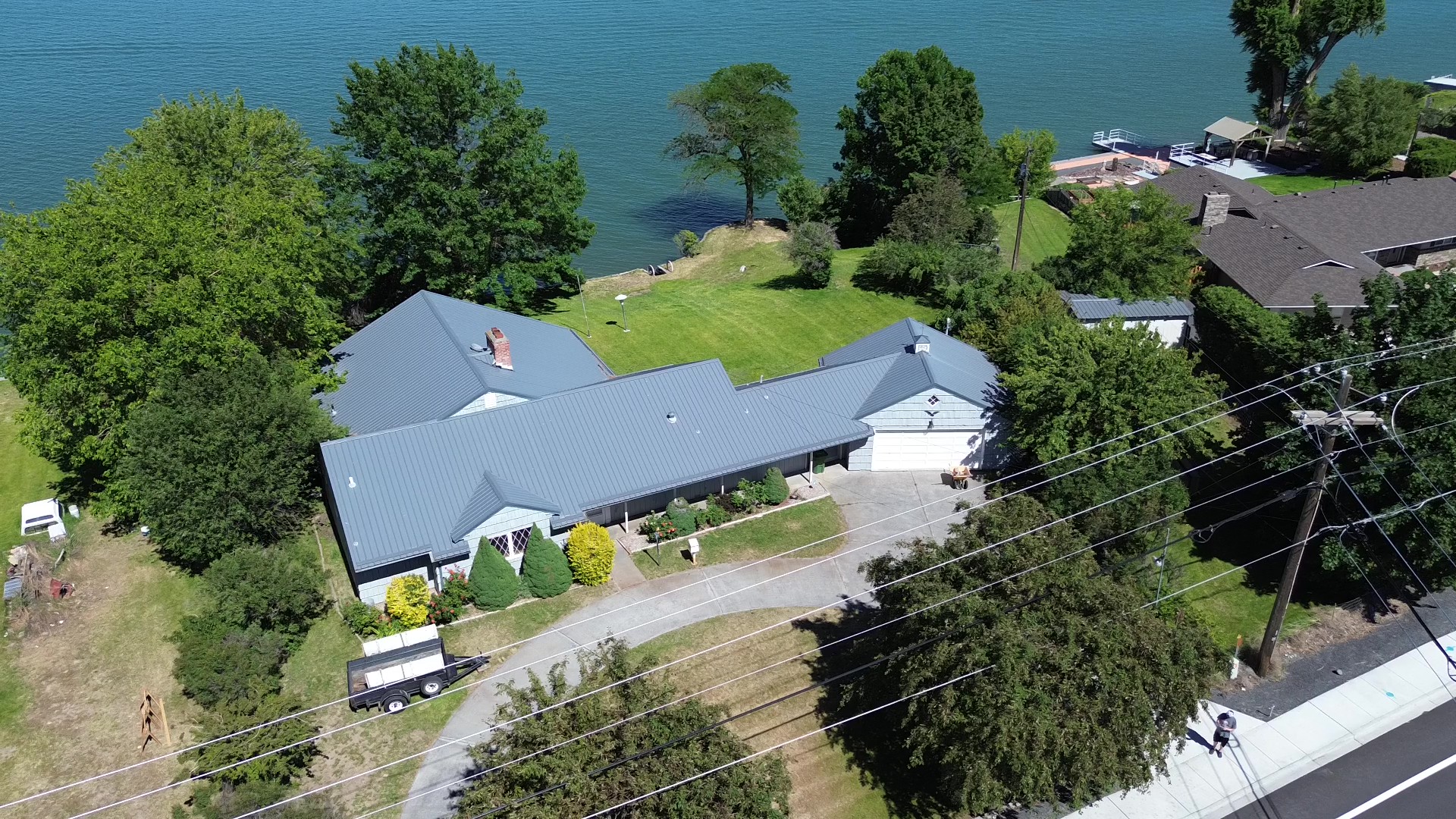
Aerial photography of a residential property on Westshore Drive near Moses Lake. Images include a straight-down nadir view suitable for georeferencing and two angled perspective shots. Additional aerial projects will be added as work is completed. Click any image to enlarge.
Blue Heron Park (southern) - Moses Lake, WA
Sanders Beach Marina - Coeur d'Alene, ID
4033 Shorecrest Drive NE - Moses Lake, WA
GIS/Geospatial Work
Pangborn-Herndon 1931 Flight
City of Wenatchee | ArcGIS Story Maps
This story map documents the 1931 transpacific flight by Clyde Pangborn and Hugh Herndon Jr., the first non-stop crossing of the Pacific Ocean, from Misawa, Japan to Wenatchee, Washington. Pangborn was originally from Bridgeport, about 50 miles northeast of Wenatchee.
Interns with the City of Wenatchee GIS program are assigned a story map on a topic connected to the Wenatchee Valley. I settled on the history behind Pangborn Memorial Airport, which felt like a natural fit given my interest in aviation. I completed the story map before leaving early to take a position with Franklin County.
South Columbia Basin Irrigation District Web Map
Franklin County | ArcGIS Web AppBuilder
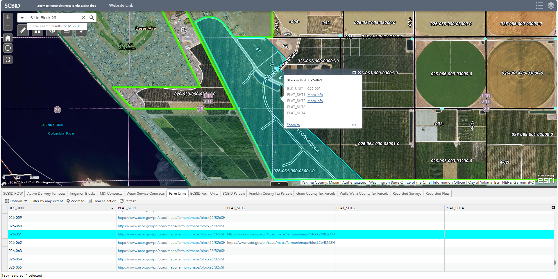
The SCBID web map was originally built through a collaboration between my predecessor and the County GIS Manager. By the time I joined, that staff member had left and the application needed significant work to get it stable and functional again within the existing ArcGIS Enterprise environment.
I rebuilt it from the ground up: re-establishing service configuration, restructuring layer behavior across scale ranges, and restoring a working public interface for district stakeholders. The map uses a zoom-based visibility system to manage a large number of layers across different scales. This was one of my first substantial projects in ArcGIS Pro and ArcGIS Enterprise, and working through the issues here built the foundation I relied on for the rest of my time at the County.
The application has since been migrated to a different platform and may differ from the version shown.
Culvert Inspection Field Map
Franklin County | ArcGIS Field Maps
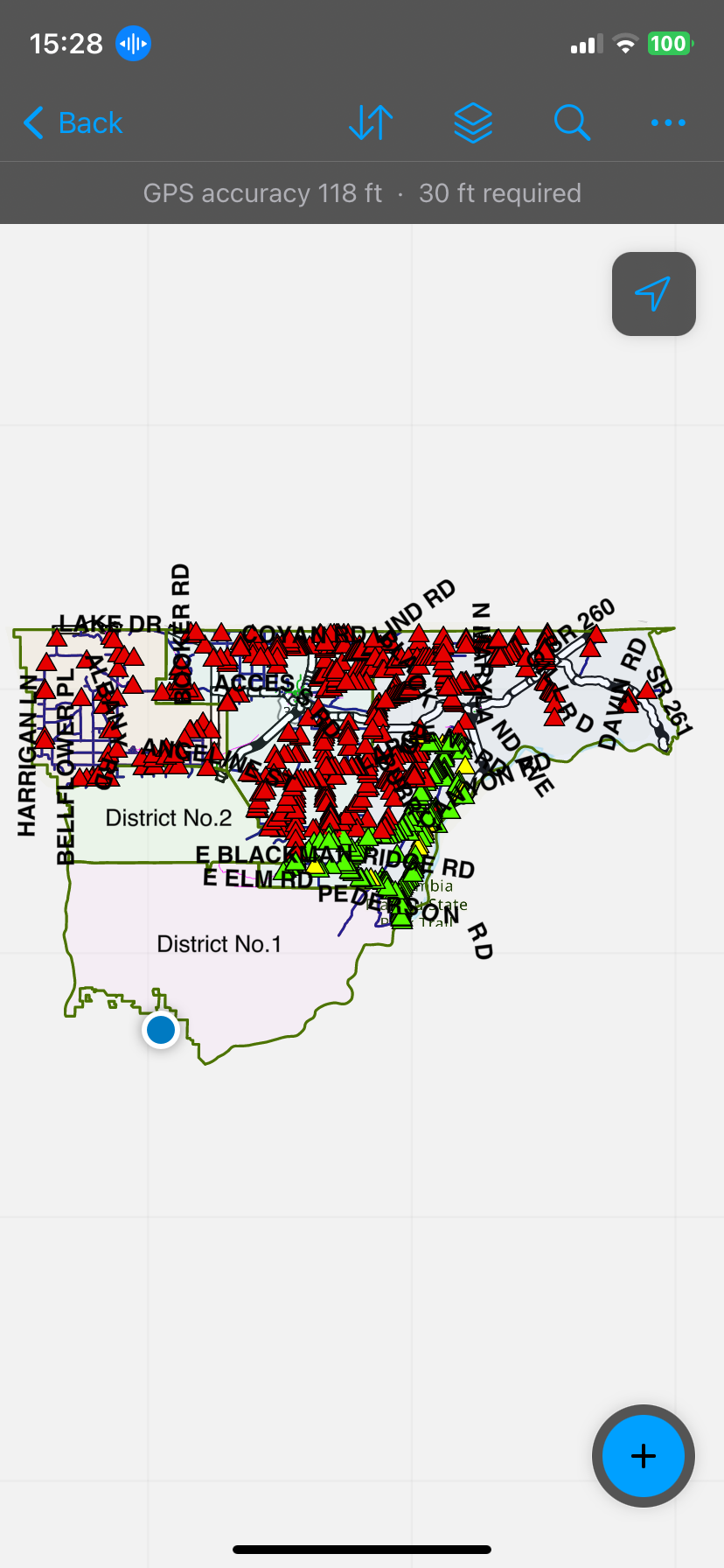
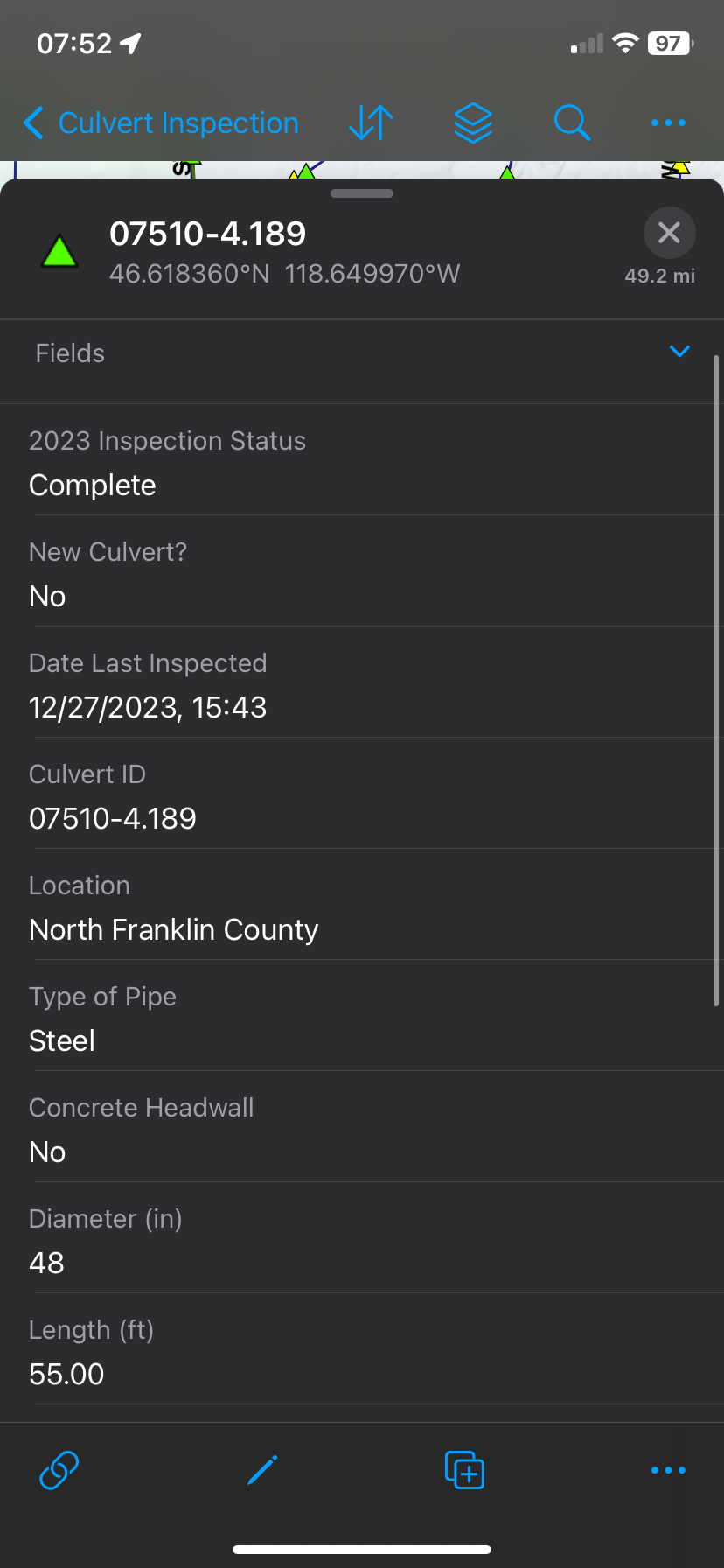
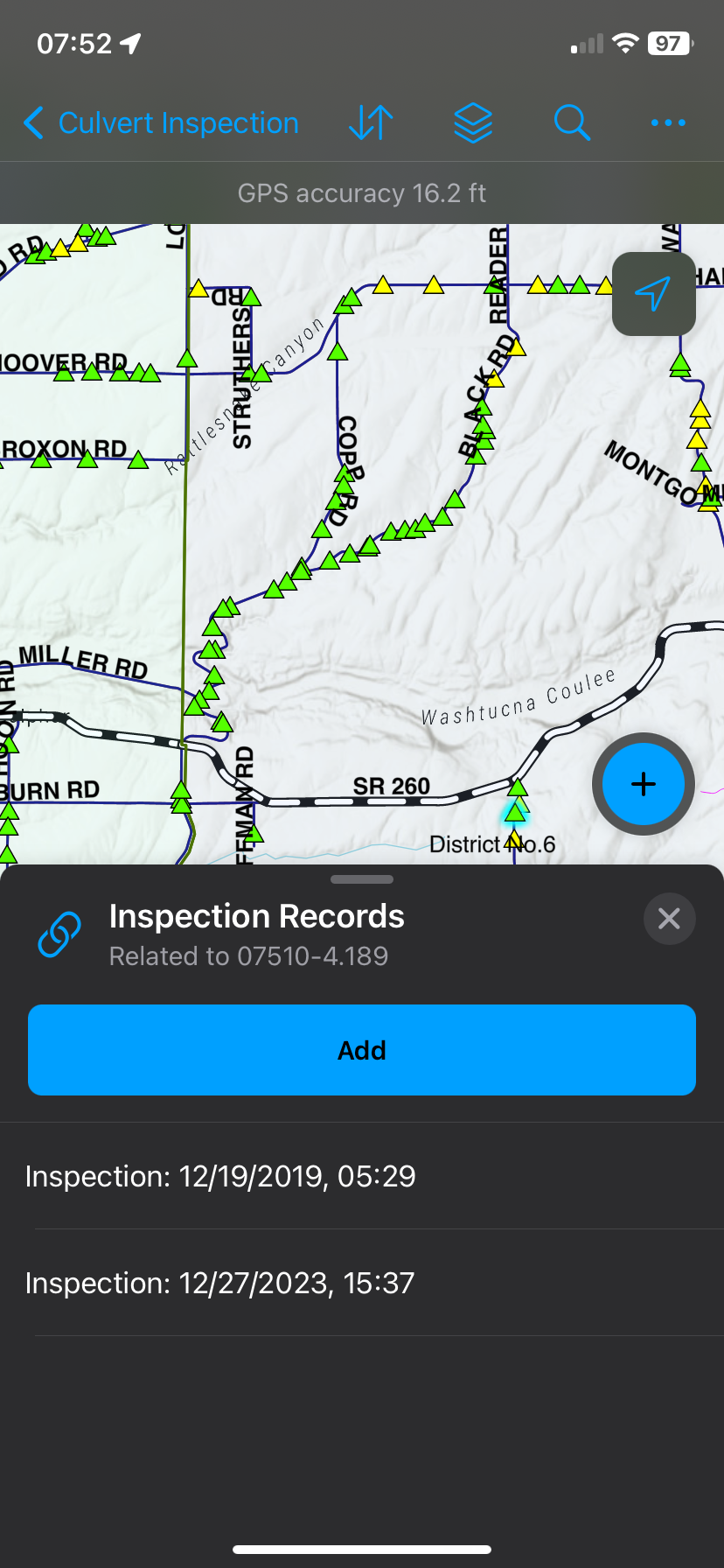
Franklin County maintains over 1,000 culverts under county roadways. Inspections had historically been done on paper forms in the field, then entered manually back at the office. I was tasked with digitizing the process using ArcGIS Field Maps.
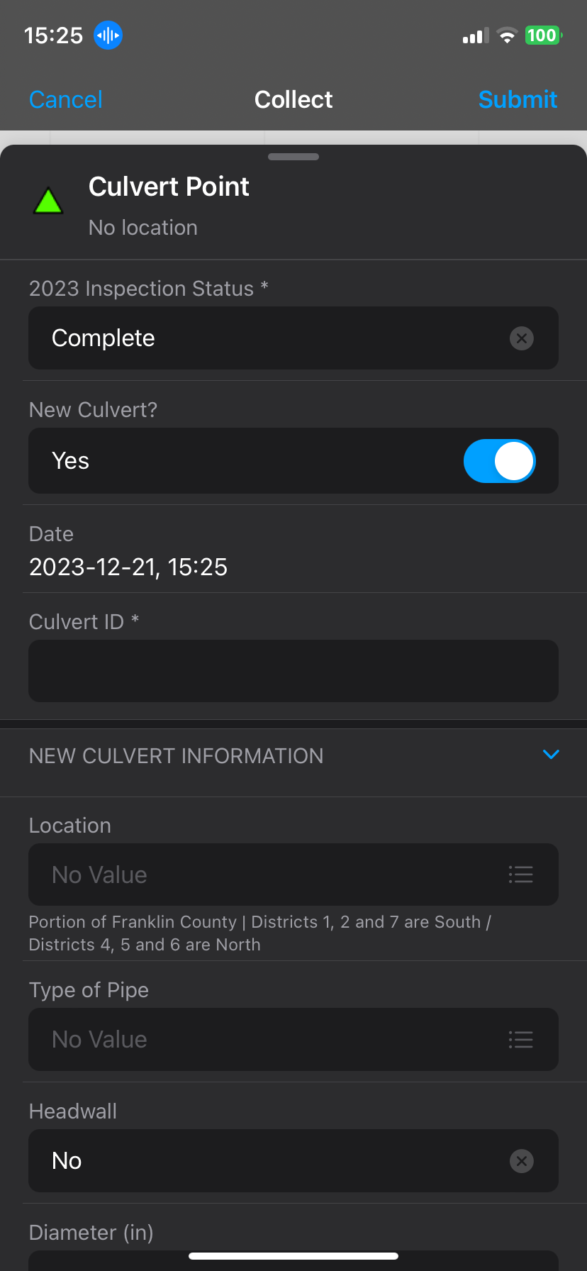
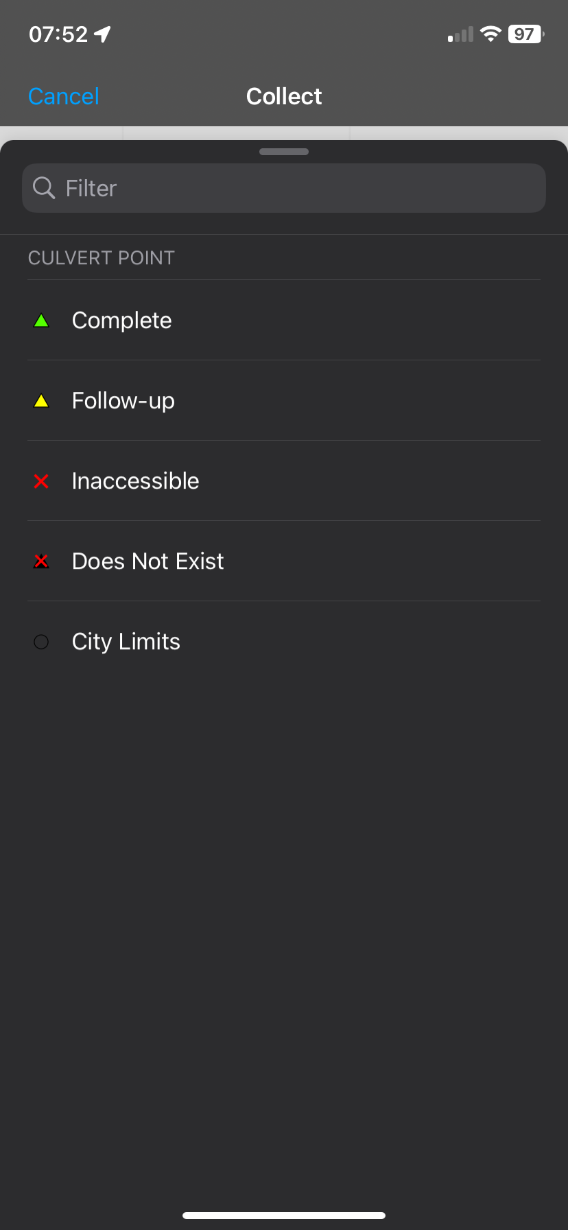
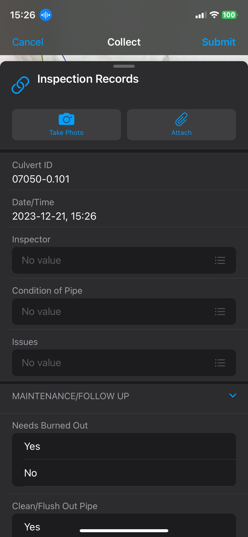
The form splits the original culverts layer into a point layer for pipe measurements and a related inspection records table, linked by a common Culvert ID. Smart Forms logic auto-calculates date fields and shows or hides field groups based on whether a culvert is new or existing. Color-coded map symbology lets the crew track inspection status in real time.
I went out with the maintenance crew in December 2023 to run the first live inspection using the app, noted what needed improving, and iterated from there. The full county inspection was completed in just over a month. I presented the project at the Tri-Cities Local GIS Network meeting in Kennewick in January 2024.
Gravel Road Maintenance Dashboard
Franklin County | ArcGIS Dashboards / Experience Builder
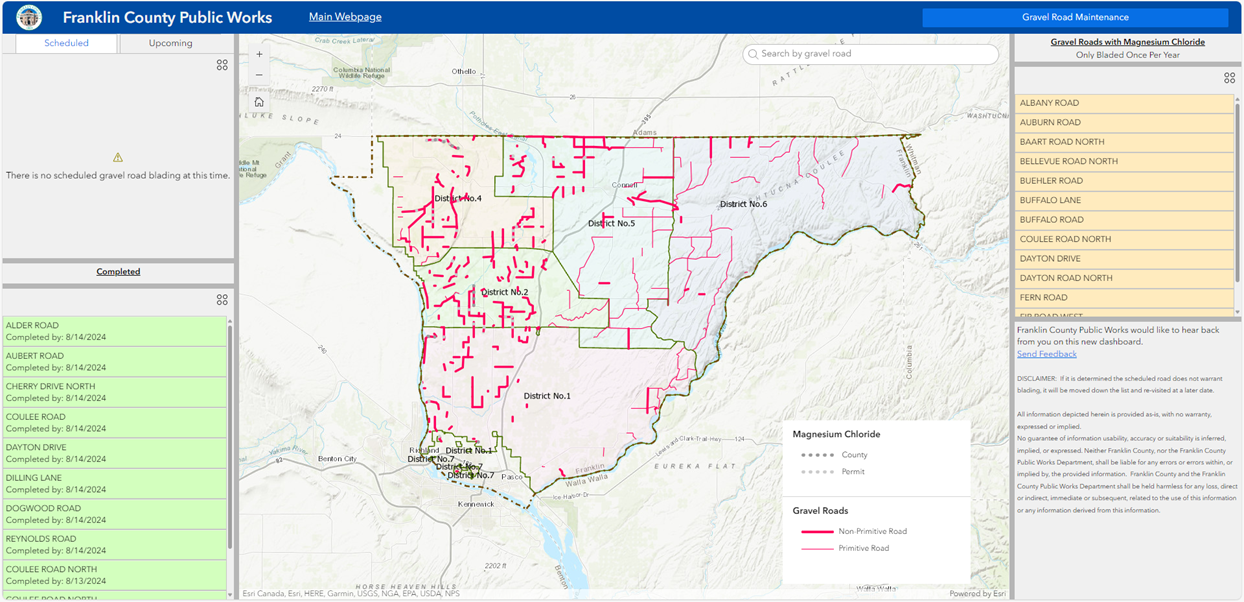
A public-facing tracking tool for gravel road blading and Magnesium Chloride application across Franklin County. The original version was built in ArcGIS Dashboards in 2023; I rebuilt it in Experience Builder for the 2024 season with two key changes: the data layer was switched from a map image service to a feature service (allowing in-place edits without republishing), and I added a related Blading Records table to log every maintenance event per road segment.
Weekly updates involved coordinating scheduled roads with crew supervisors and tracking completed work through the County's WinCAMS timecard system. The Experience Builder version also added a more capable search and click-through pop-ups from both the map and the list panels.