Atlantic Tsunami Simulation and Web Mapping Project
Independent research — Central Washington University
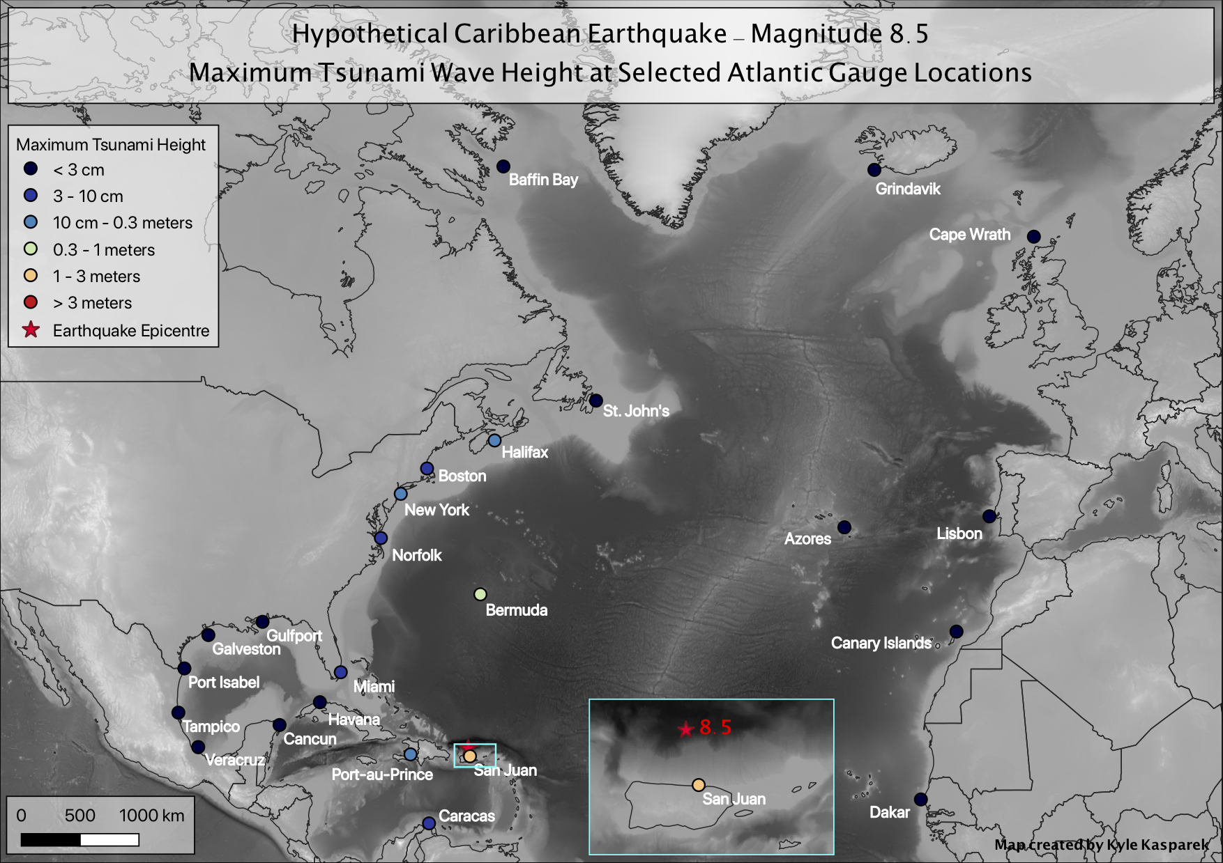
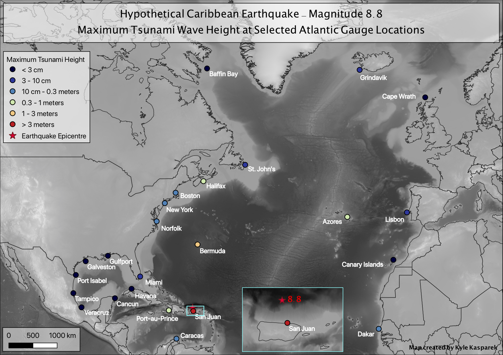
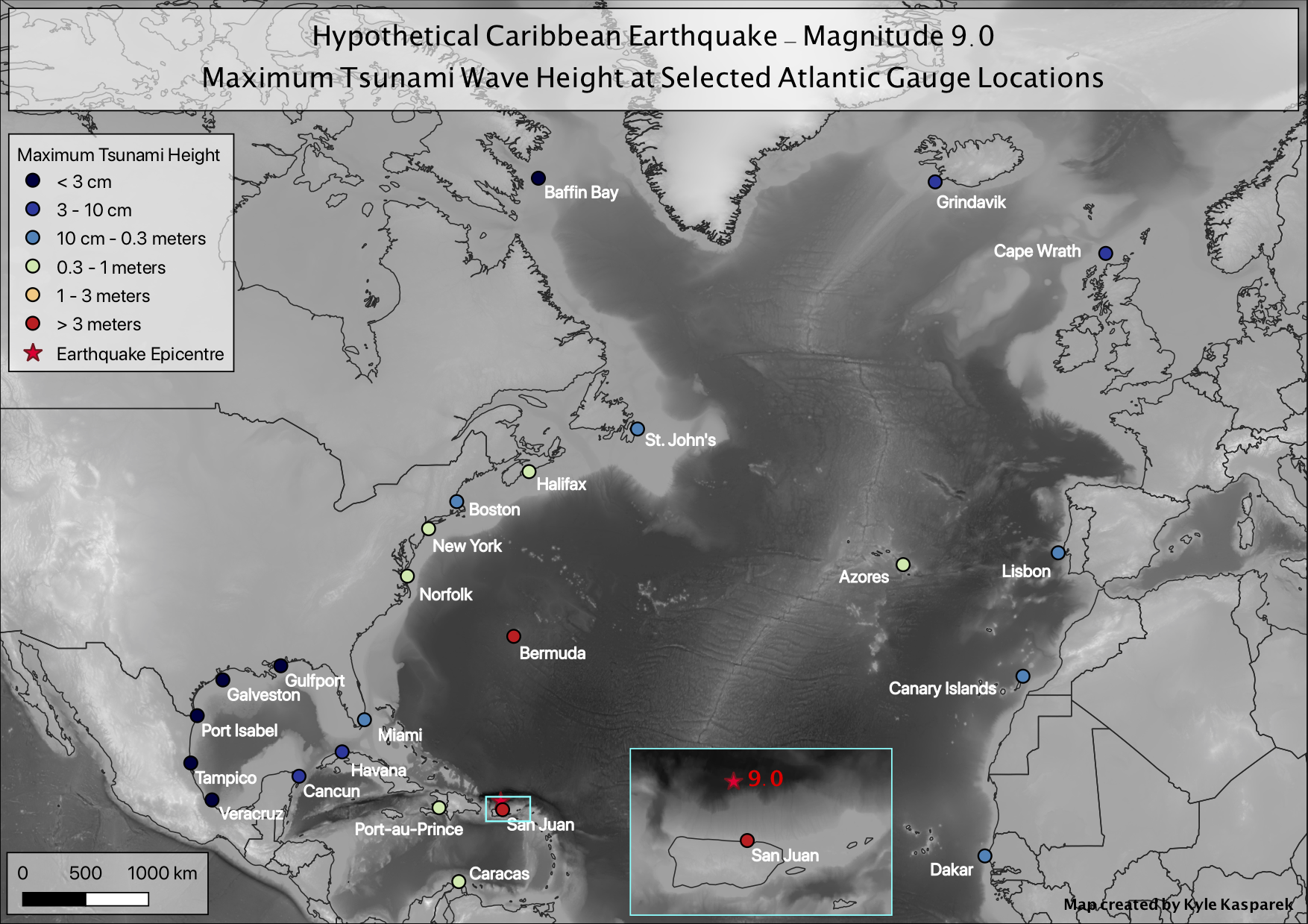
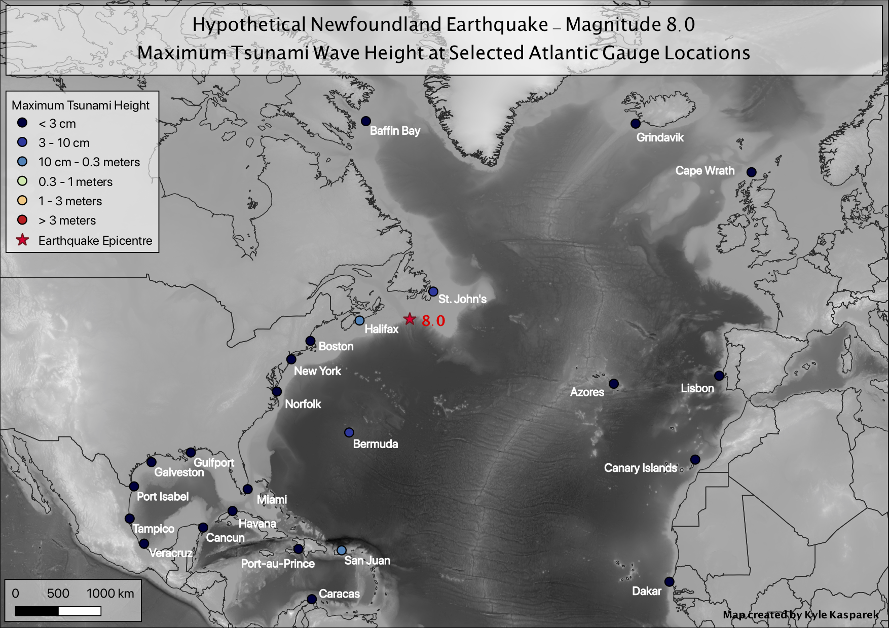
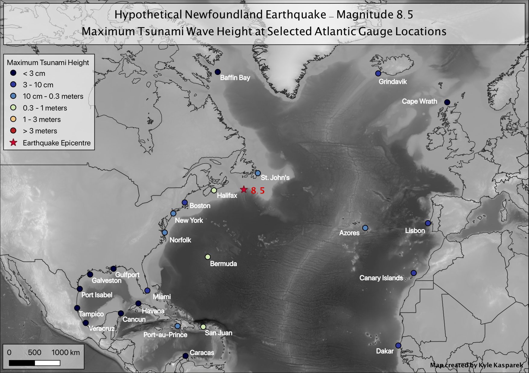
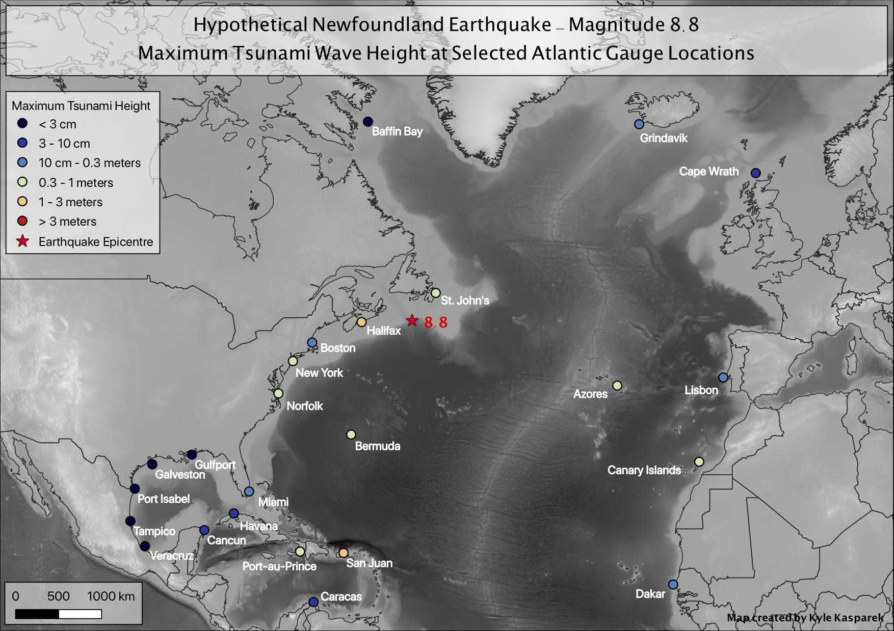
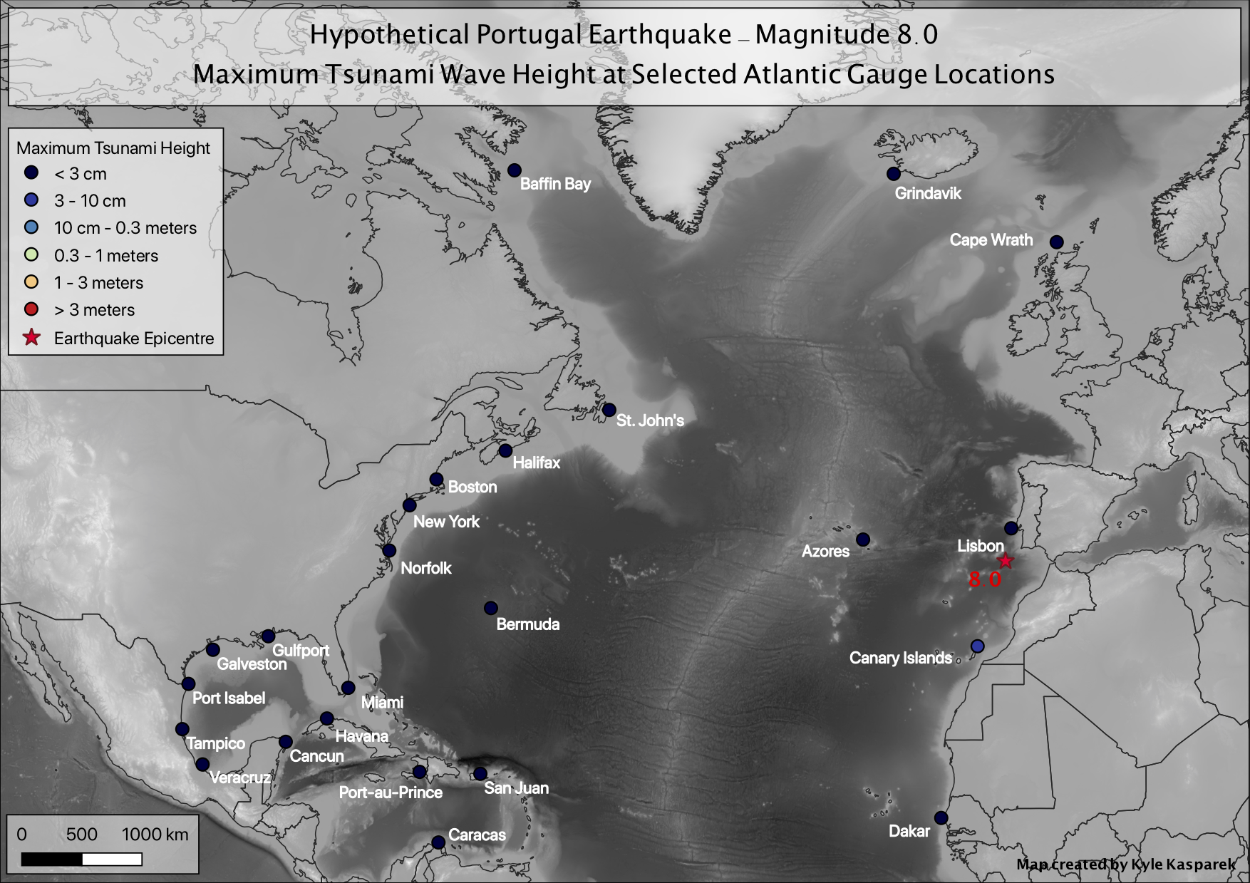
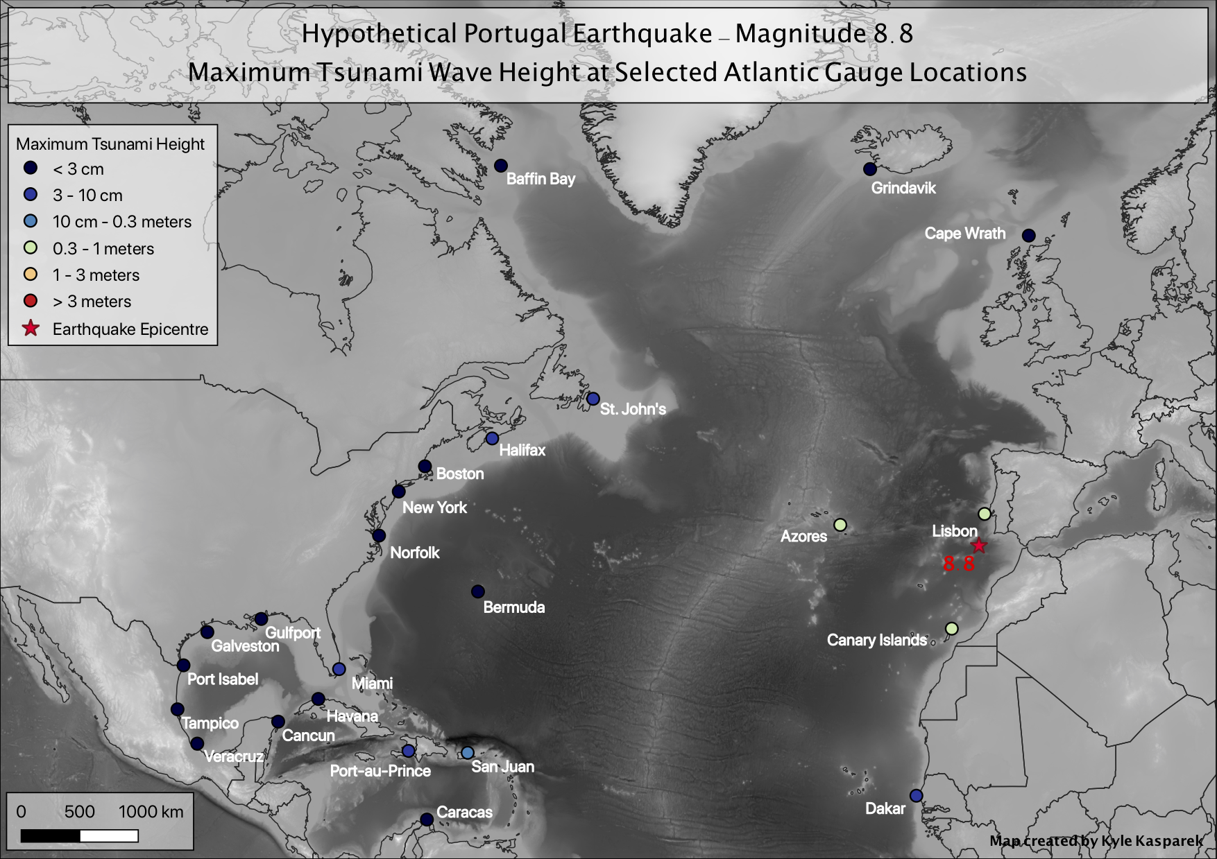
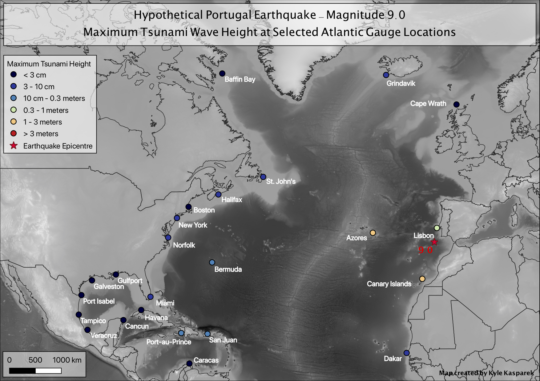
This project was completed as independent research at Central Washington University. Using the GeoClaw numerical modelling software, I simulated hypothetical undersea earthquakes at three locations in the Atlantic basin — off Puerto Rico, the coast of Portugal, and Newfoundland — and modelled the resulting tsunami wave propagation and inundation across the Atlantic Ocean.
Each location was modelled at multiple earthquake magnitudes, ranging from Mw 7.5 to Mw 9.0 depending on the fault zone. Wave height data was extracted at 24 gauge locations across the Atlantic, from Halifax to the Canary Islands. The print maps and interactive web maps below show the results for each scenario.
Print Maps by Scenario


Interactive Leaflet Web Maps
Select a scenario below to load the corresponding Leaflet map and wave height data. Blue circles on the map indicate gauge locations.
| Location | 7.5 | 8.0 | 8.5 | 8.8 | 9.0 |
|---|---|---|---|---|---|
| Caribbean (Puerto Rico) | |||||
| Portugal | |||||
| Newfoundland |
Maximum Tsunami Wave Height
| Gauge Location | Wave Height | Arrival hh:mm |
|
|---|---|---|---|
| Halifax, NS | |||
| Boston, MA | |||
| New York, NY | |||
| Norfolk, VA | |||
| Miami, FL | |||
| Galveston, TX — 60 km | |||
| Tampico, Mexico | |||
| Cancun, Mexico | |||
| Havana, Cuba | |||
| Port-au-Prince, Haiti | |||
| San Juan, PR | |||
| Dakar, Senegal | |||
| St. Johns, NL | |||
| Gulfport, MS / New Orleans, LA | |||
| Port Isabel, TX | |||
| Veracruz, Mexico | |||
| Caracas, Venezuela | |||
| Lisbon, Portugal | |||
| Grindavik, Iceland | |||
| Nuuk, Greenland — 50 km | |||
| Cape Wrath, Scotland | |||
| Bermuda | |||
| Canary Islands — Parque Archipelago | |||
| Azores — Ponta Delgada | |||