Collection of Maps from GIS Courses
Featured on this page is a wider collection of various assignments and projects completed for select GIS courses taken at Central Washington University.
Courses featured include: GEOG301 (Intro to GIS & Maps), GEOG303 (GIS & Data Management), GEOG404 (GIS Analysis), and GEOG417 (Workplace GIS)
| GEOG301: Intro to GIS & Maps | GEOG303: GIS & Data Management | GEOG404: GIS Analysis | GEOG417: Workplace GIS |
GEOG301: Intro to GIS & Maps (Top)
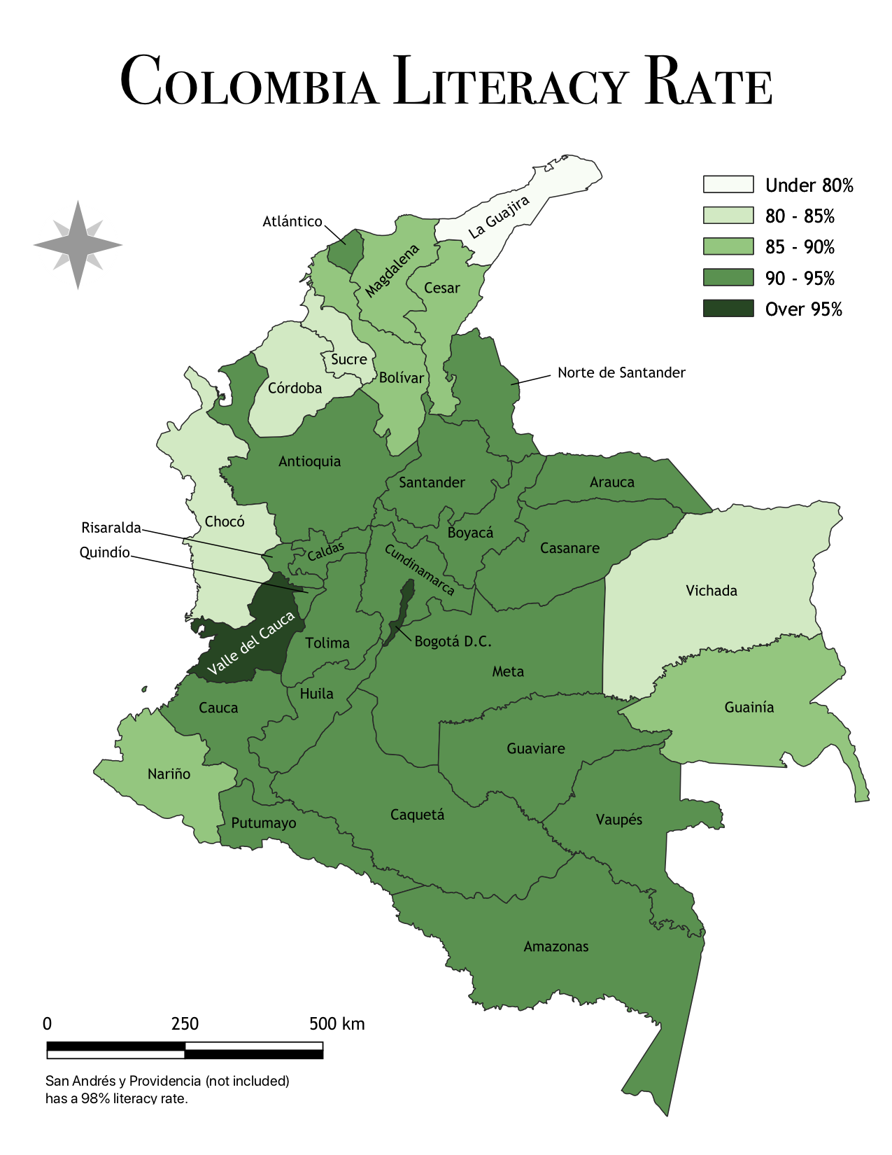
Colombia Literacy Rate Choropleth |
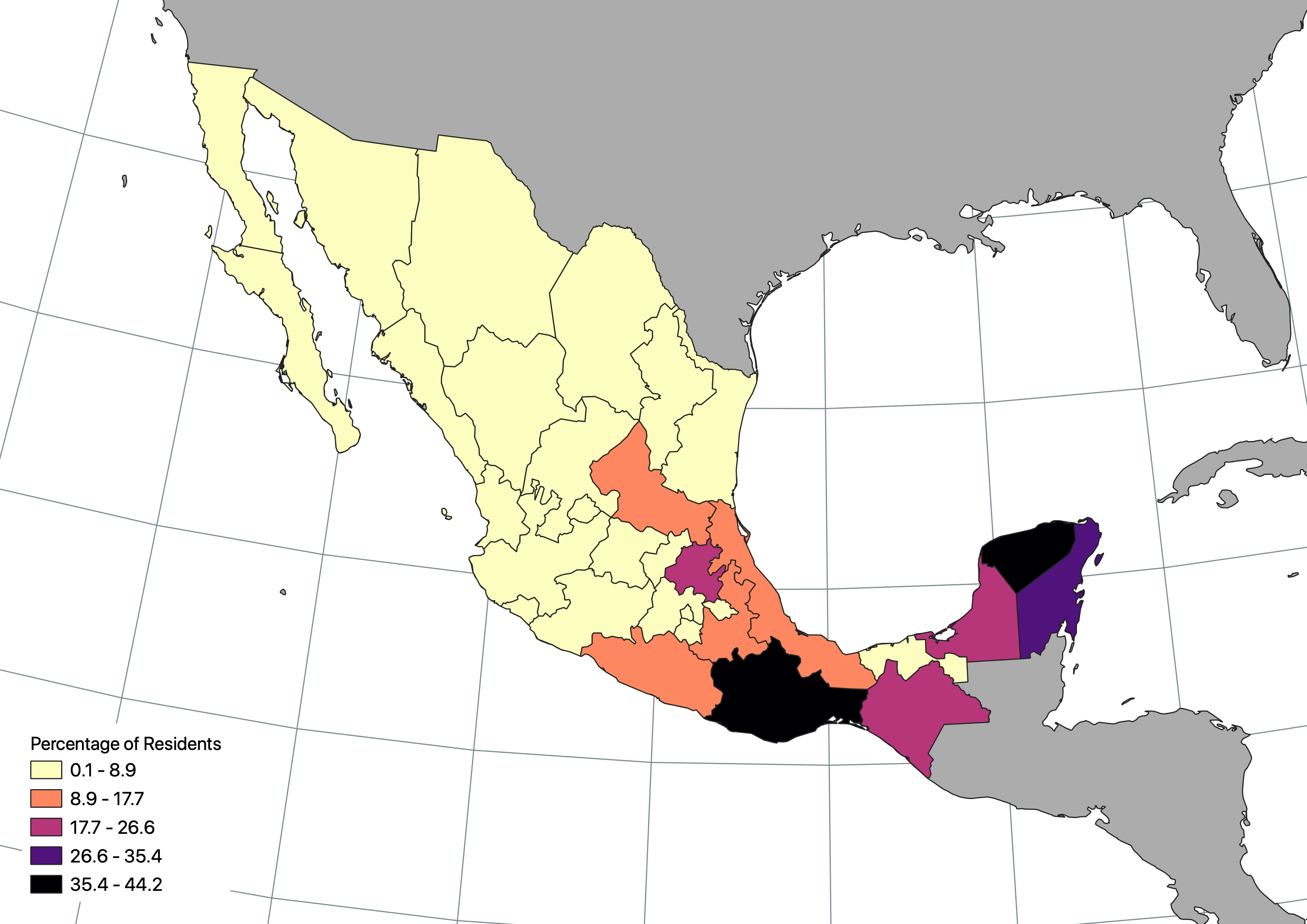
Mexico Indigenous Language Use |
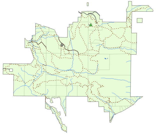
Couglar Mountain Tourist Map |
GEOG303: GIS & Data Management (Top)
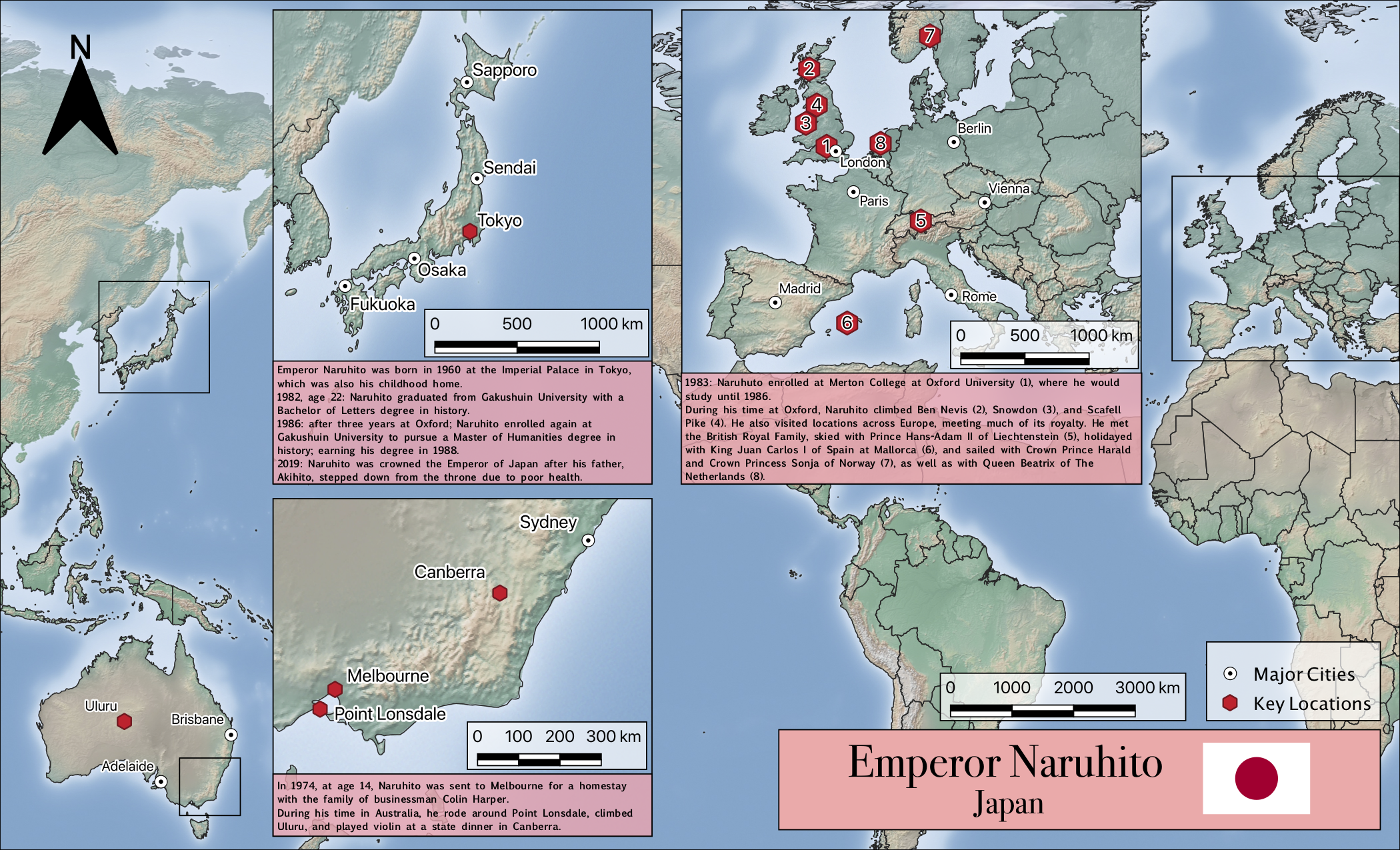
Emperor Naruhito Timeline Map |
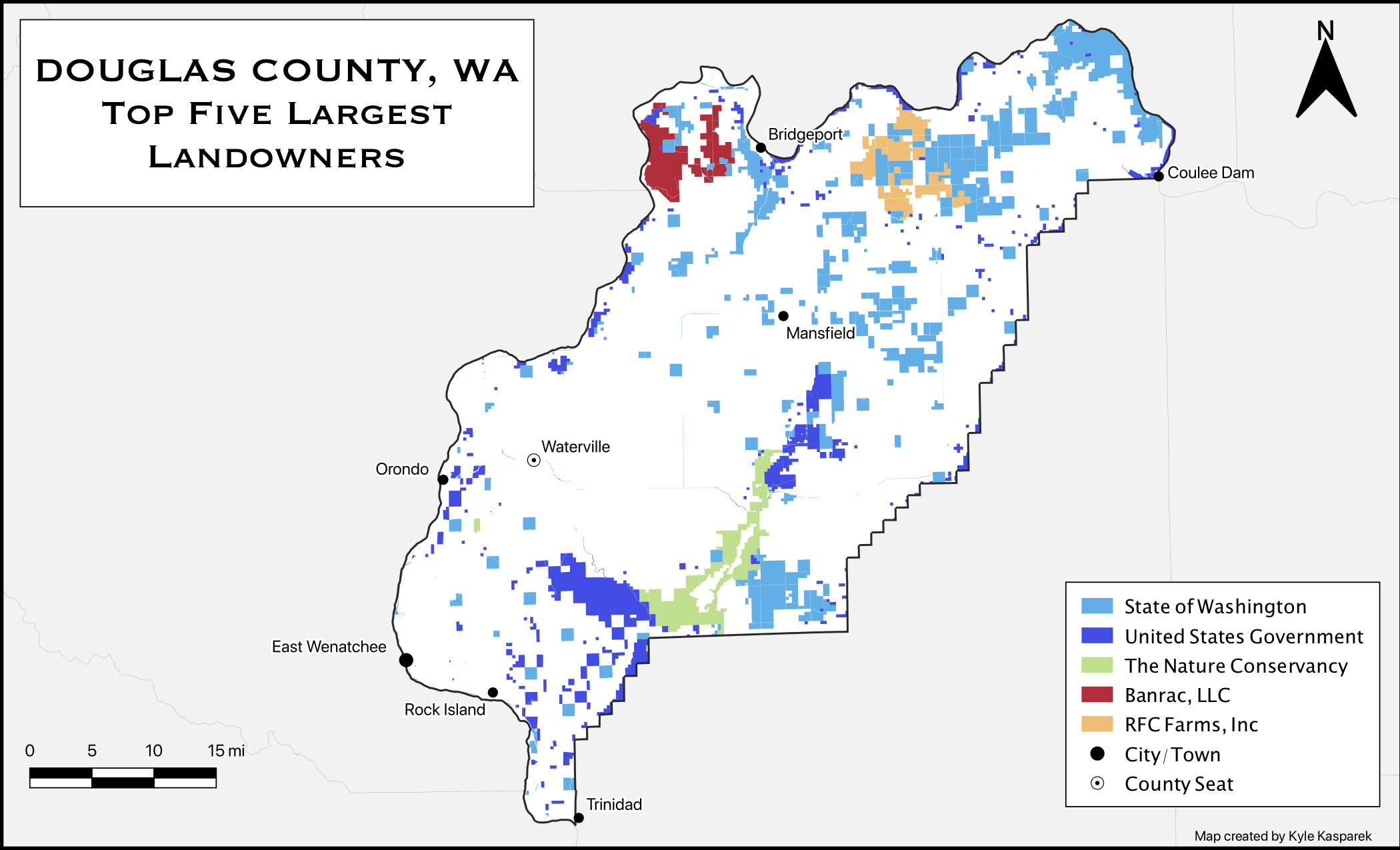
Douglas County Landowners |
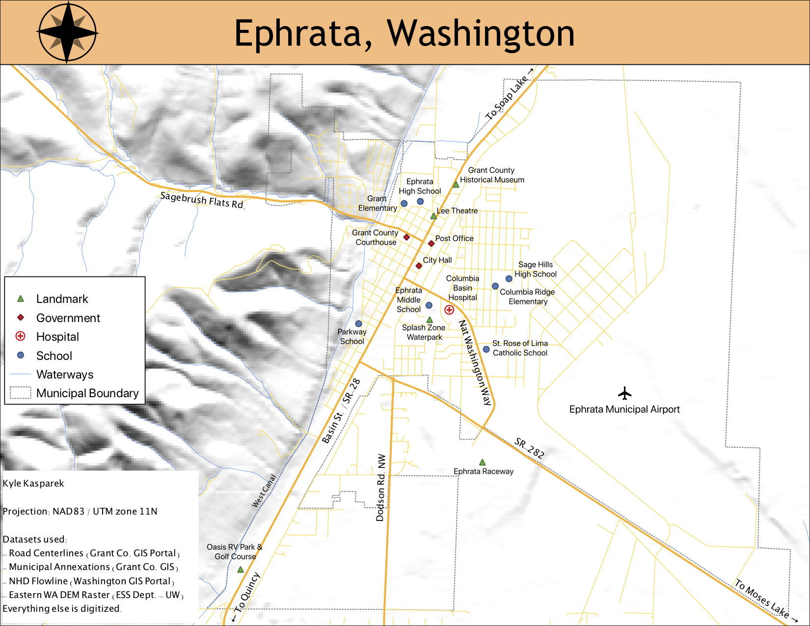
Ephrata Street Map |
GEOG404: GIS Analysis (Top)
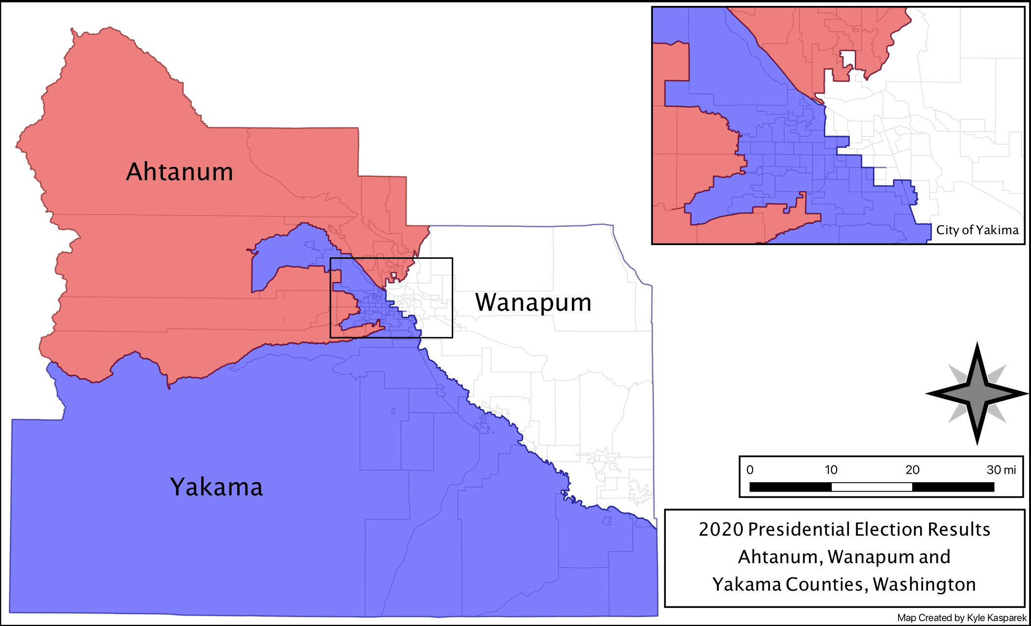
Yakima Gerrymander Map |
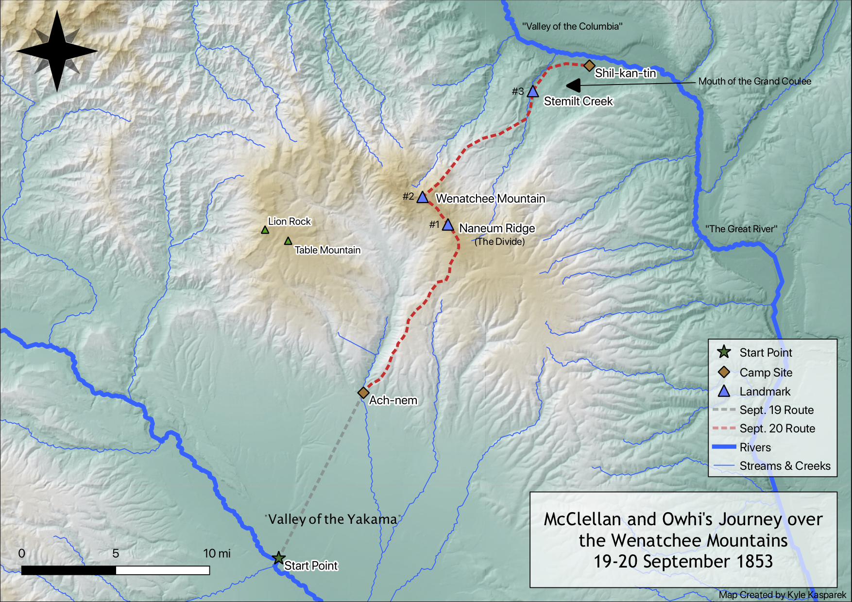
McClellan and Owhi Over The Wenatchee Mountains |
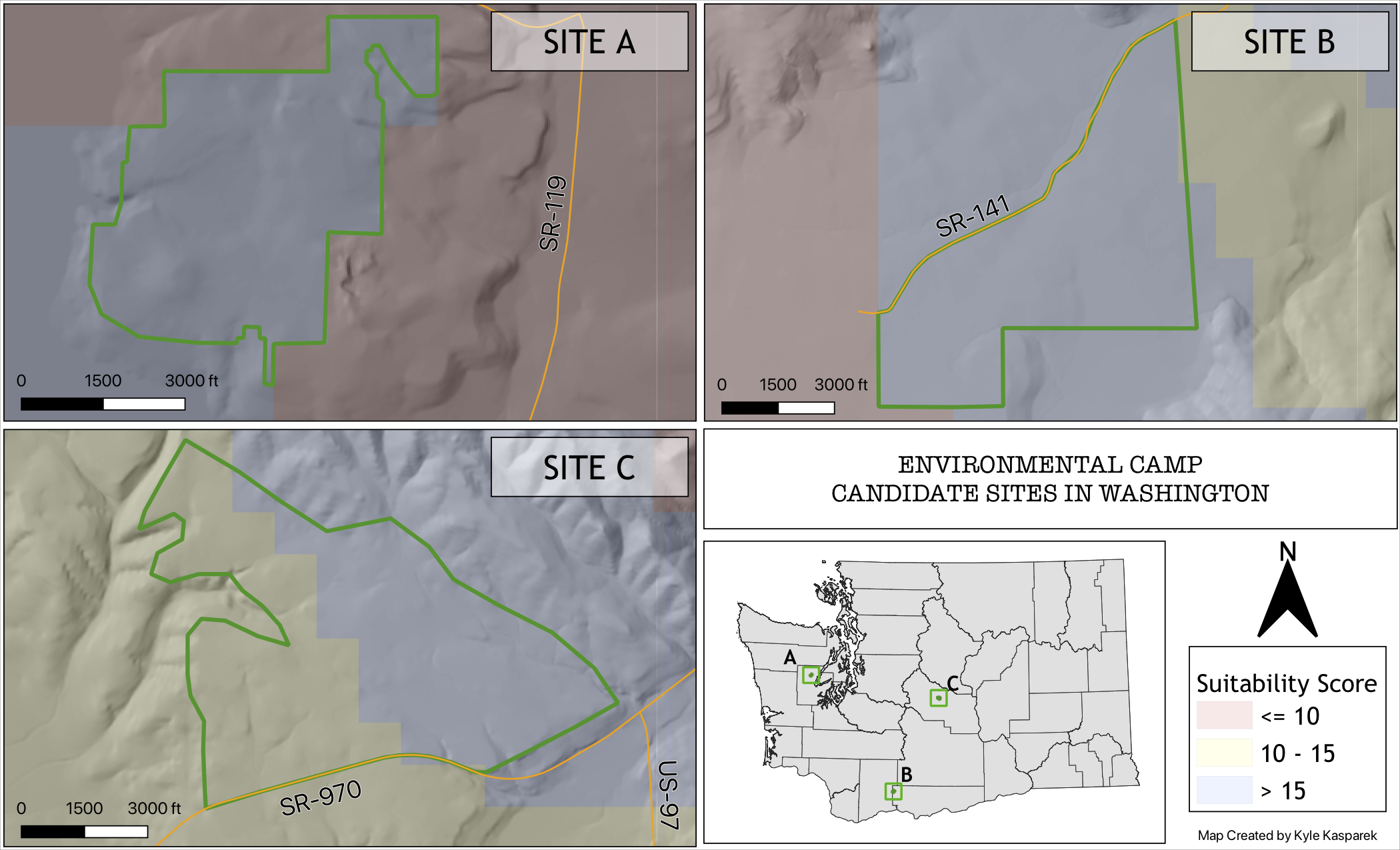
Environmental Camp Site Selection |
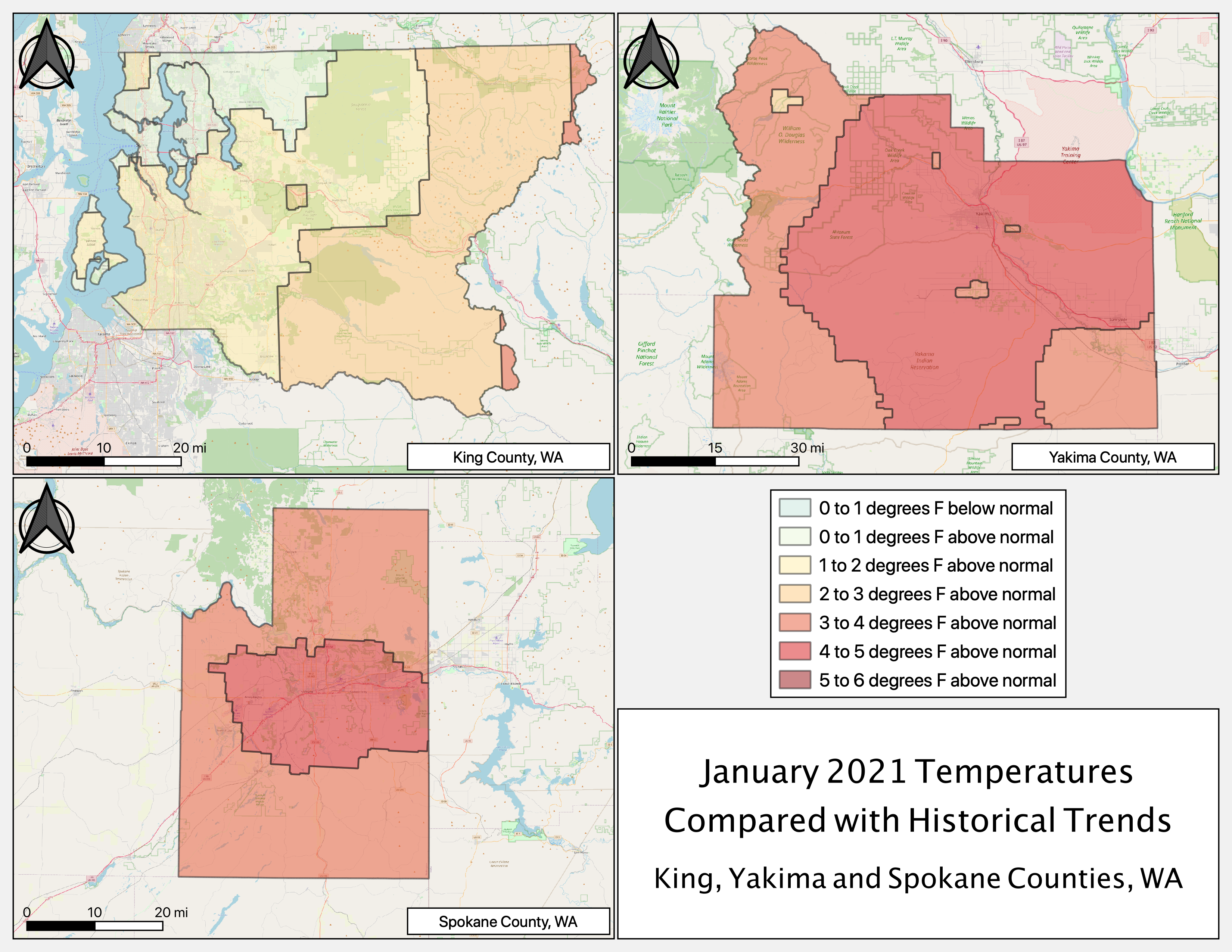
January 2021 Temperatures Compared with Historial Trends |
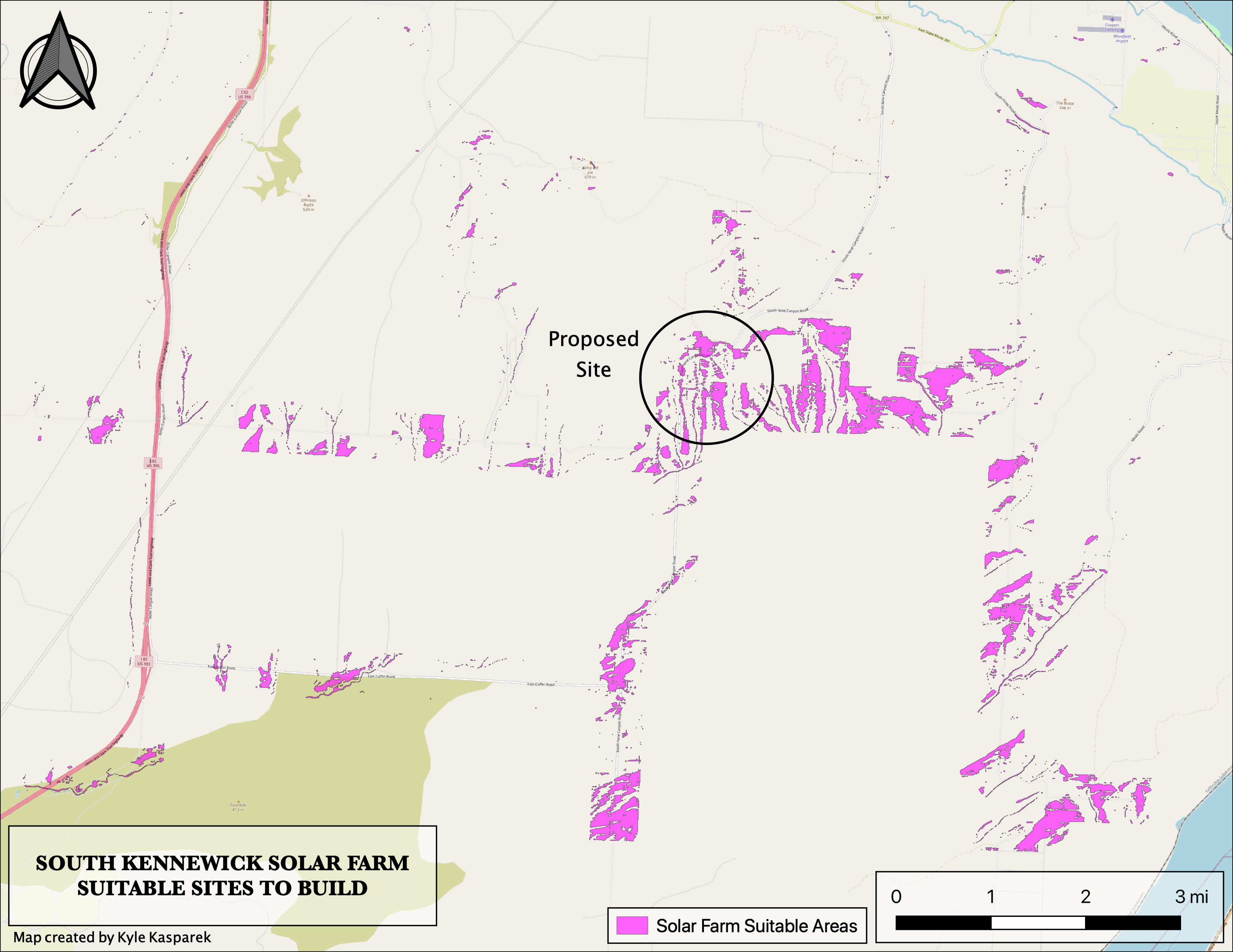
South Kennewick Solar Farm Map |
GEOG417: GIS Analysis (Top)
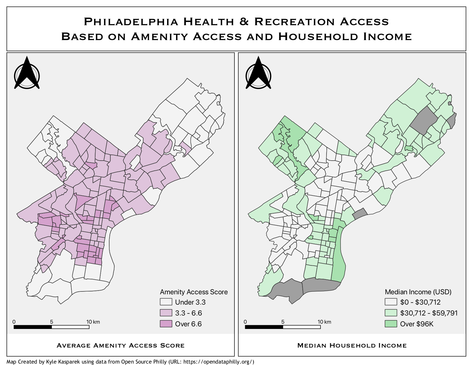
Philadelphia Amenity Access - Side by Side |
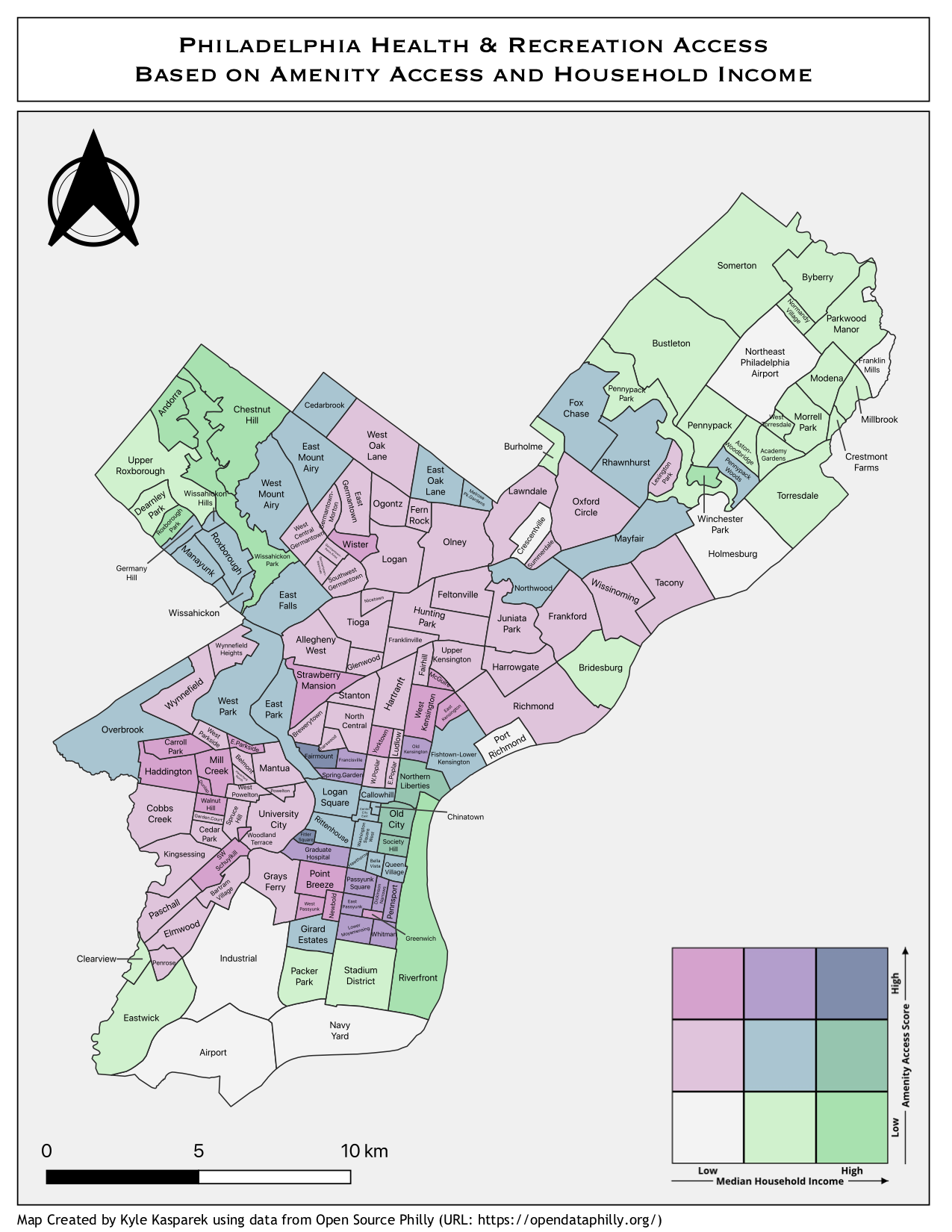
Philadelphia Amenity Access - Bivariate |
|
Philadelphia Amenity Access - Interactive Bivariate |